
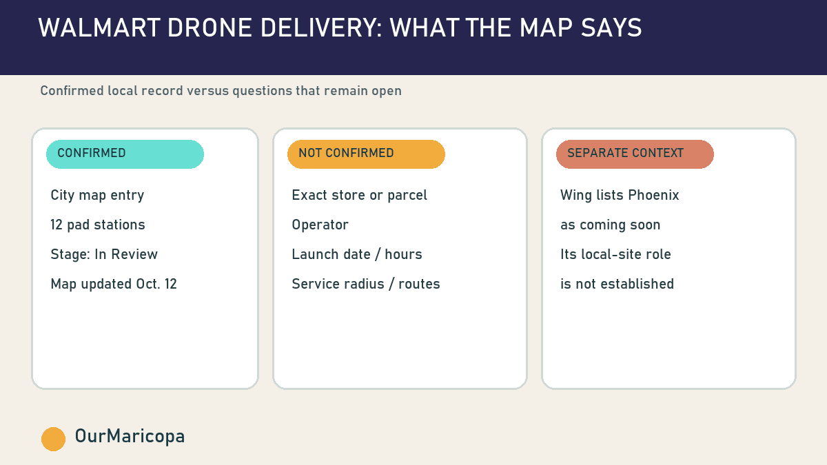
Maricopa’s development map has a new entry likely to make residents look twice: “Walmart Drone Delivery,” described by the City as a delivery service with 12 drone pad stations.
The project appears in the map’s In Review section. That distinction matters. The listing confirms that detailed plans have entered the City’s review process; it does not show that the project has final approval, a construction permit or a launch date.
It also leaves the biggest consumer questions unanswered. The public map entry does not identify the Walmart store or parcel, name the drone operator, define a delivery radius, list operating hours or say when Maricopa customers could become eligible.
For now, the most accurate description is simple: a 12-pad Walmart drone delivery project is under City review, and the public record is still thin.
What “In Review” means
The City’s own development-map guide says projects in this stage have submitted detailed plans and are working through permitting. Review can cover the site plan, access, parking, building elevations, lighting, landscaping and studies tied to traffic or drainage.
That process is different from the map’s Under Construction and Recently Completed categories. The drone project is not listed in either of those later stages.
Unlike several other In Review entries, the Walmart drone listing does not display a public site-plan or elevation link in the map panel. Without that document, residents cannot yet evaluate where the 12 stations would sit, how vehicles or staff would reach them or how the facility would relate to nearby homes and businesses.
Why 12 pads stand out
A pad is the local piece of a drone-delivery network: a designated place for aircraft to launch, land, load or wait between trips. The City’s description does not explain whether all 12 stations would operate at once or how the proposed site would be organized.
The number still signals more than a one-off demonstration. A 12-station plan suggests infrastructure intended for recurring service, subject to the City review, aviation rules, operator decisions and customer demand.
That is where the project becomes locally consequential. Residents may want to know which neighborhoods could receive deliveries, whether flight paths would pass near homes, what noise to expect and how operations would work during windy or extreme-heat conditions. None of those details appears in the accessible map entry.
A separate Phoenix-area clue—with an important limit
Wing, a drone-delivery company owned by Alphabet, announced in June that it and Walmart planned to expand into seven additional metropolitan markets, including Phoenix. Wing’s Walmart page currently labels Phoenix “Coming soon.”
Wing says its service can move small orders at speeds up to 60 mph and lower a package by tether to a customer’s yard or driveway, sometimes in as little as 30 minutes. Those are general descriptions of Wing’s service, not specifications for Maricopa.
The Phoenix-market announcement and Maricopa’s Walmart-branded map entry are geographically compatible. They do not, by themselves, prove that Wing would operate this particular 12-pad facility. Walmart also works with Zipline in other markets, and the City’s public entry does not identify a vendor.
Walmart reported in May that it had passed one million drone deliveries across its network, which then covered 66 stores in four states and five metro areas. That milestone shows the company is moving beyond pilot projects. It does not establish when, where or under what conditions service would begin in Maricopa.
What residents should watch next
The next useful public record would be a site plan naming the parcel and showing the pad layout. After that, residents should watch for a stage change on the City development map, permit activity and a first-party Walmart or operator announcement naming Maricopa.
Those records could answer the practical questions the map does not:
Which Walmart location or parcel is tied to the project?
Who would operate the drones?
Which addresses could qualify, and what package limits would apply?
What hours, routes, safety procedures and weather limits are proposed?
When would the City review be complete, and what approvals remain?
Until those details appear, customers should not assume the service is available. The OurMaricopa directory remains the more immediate way to find local shopping and services, while the development map is the best official place to track this proposal’s stage.
Sources
City of Maricopa — What’s New Maricopa development StoryMap; updated Oct. 12, 2026; accessed Oct. 21, 2026. https://maps.maricopa-az.gov/portal/apps/storymaps/stories/bd9c5f422f294914a92f56fd222db8f5
City of Maricopa — Wondering What’s Being Built in Maricopa? Here’s Where to Look; published May 12, 2026; accessed Oct. 21, 2026. https://www.maricopa-az.gov/Maricopa-eNews/Wondering-Whats-Being-Built-in-Maricopa-Heres-Where-to-Look
Wing — Wing and Walmart to Expand Drone Delivery to Seven New Markets; published June 8, 2026; accessed Oct. 21, 2026. https://wing.com/news/wing-and-walmart-seven-new-markets-drone-delivery
Wing — Walmart drone delivery locations; no publication date shown; accessed Oct. 21, 2026. https://wing.com/walmart
Walmart — Walmart Celebrates 1 Million Drone Deliveries; published May 29, 2026; accessed Oct. 21, 2026. https://corporate.walmart.com/news/2026/05/29/walmart-celebrates-1-million-drone-deliveries-marking-a-major-milestone-in-customer-convenience