
State Route 347 is the main connection between Maricopa and Interstate 10, which makes a small change in traffic, weather, construction, or an incident matter to thousands of daily trips. A useful SR-347 commuter routine starts before you leave: check live conditions, understand the active project, and keep your attention on the road once you are moving.
This guide combines the OurMaricopa SR-347 dashboard with official Arizona Department of Transportation resources so you can make a better-informed travel decision.
Check live SR-347 traffic before you drive
OurMaricopa's live SR-347 page is designed for a quick pre-trip check. It brings together:
Estimated northbound travel time from Maricopa to I-10.
Estimated southbound travel time from I-10 to Maricopa.
A live corridor map with road updates and camera markers.
Official Arizona 511 roadwork and incident messages.
Camera views around I-10, Old Maricopa Road, Riggs Road, Cement Plant Road, and Casa Blanca Road.
The page displays the time of its latest update so you can judge how current the information is. Conditions can change in minutes, and an estimate is not a guarantee.
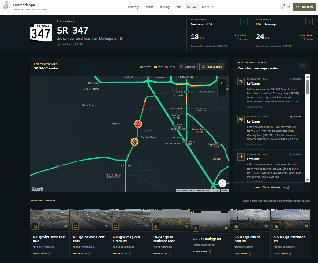
Check the dashboard before leaving or have a passenger review it. Do not use the page while driving.
What is changing on SR-347?
The SR-347 Improvement Project covers a 14-mile section between I-10 and the City of Maricopa. Construction is underway, with overall completion currently scheduled for late 2029.
ADOT's planned improvements include:
Adding one lane in each direction between I-10 and Maricopa.
Building a concrete median barrier between opposing directions of travel.
Rehabilitating pavement along the corridor.
Constructing grade-separated interchanges at Riggs Road and Mammoth Way.
Adding turn lanes and other intersection improvements at Casa Blanca Road and Maricopa Road.
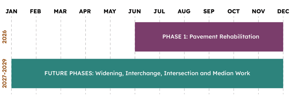
Phase 1 focuses on pavement rehabilitation from July through December 2026. Future phases include widening, interchange construction, intersection work, and the median barrier.
What commuters should expect during construction
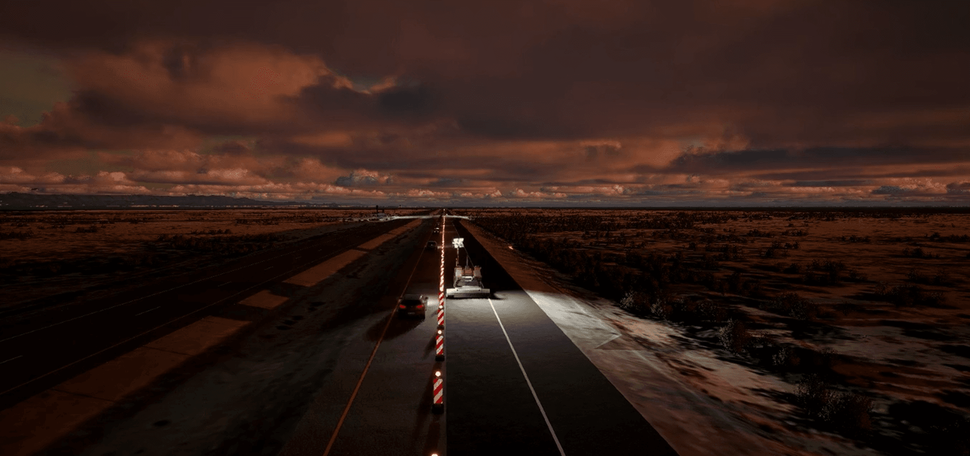
ADOT's traffic-management plan says two lanes will be maintained in each direction during weekday commute hours. Most lane restrictions are expected overnight and on weekends. The project schedule can still change because of weather, field conditions, or other unforeseen circumstances.
ADOT lists a reduced speed limit of 55 mph throughout the 14-mile project corridor and 45 mph in active work zones. Follow posted signs, merge carefully, and watch for crews and equipment.
The practical lesson is simple: a normal weekday commute may look different from a late-night return, an early Saturday trip, or a Sunday evening drive. Check the current messages every time the timing of your trip changes.
A five-minute pre-trip routine
Open the OurMaricopa dashboard. Compare the northbound or southbound estimate with normal flow.
Read the active messages. Note direction, milepost or intersection, start time, and end time.
Look at the cameras. A current image can help you understand visible flow and weather, but it only shows one location at one moment.
Leave a reasonable buffer. Construction, collisions, weather, and special events can change a travel estimate after you depart.
SR-347 locations worth recognizing
Interstate 10 and Wild Horse Pass
The northern end of the corridor connects with I-10 and nearby freeway traffic. Congestion on I-10 can affect the final portion of a northbound trip even when SR-347 itself appears to be moving.
Riggs Road and Mammoth Way
These intersections are scheduled for grade-separated interchanges as part of the current improvement project. Expect traffic control and construction activity to evolve as project phases move forward.
Casa Blanca Road and Maricopa Road
ADOT plans turn-lane and intersection improvements at these locations. Watch active messages for the direction, time window, and exact segment affected by current work.
The Maricopa city approach
Old Maricopa Road and the southern approach are useful camera and map reference points as traffic enters or leaves the city. Local signals, events, and activity on John Wayne Parkway can affect the trip beyond the state highway project area.
Safer travel habits during the project
Slow down for posted work-zone limits and changing lane patterns.
Leave extra following distance and avoid last-second lane changes.
Expect workers, equipment, uneven surfaces, and temporary markings.
Secure your phone before moving and use hands-free navigation.
Let someone know when a closure or severe delay changes your arrival time.
Quick answers
Where can I see SR-347 traffic cameras?
Use the camera section on OurMaricopa's SR-347 page for a corridor-focused view, or use AZ511 for the official statewide map.
When will the SR-347 project be finished?
ADOT currently says the overall improvement project is slated for completion in late 2029. Construction schedules can change.
Will lanes stay open during weekday commute hours?
ADOT's current traffic-management plan says two lanes will be maintained in each direction during weekday commute hours, with most restrictions overnight and on weekends. Always check current alerts.
Is OurMaricopa an official transportation agency?
No. OurMaricopa is an independent community dashboard. Official road, camera, and alert information comes from Arizona 511 and ADOT when connected.
Project and corridor information reviewed September 14, 2026. Construction schedules and travel conditions can change quickly. Follow posted traffic controls and confirm official restrictions with ADOT and Arizona 511.